The Tour
Five Boroughs,
One Route
A guided walking tour through every stop, with transit connections and narrated segments between each point of interest.
Starting Point
Begin at the southern tip of Manhattan's Financial District
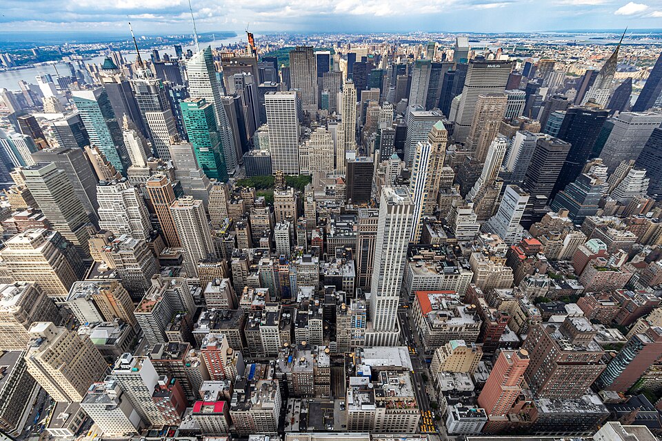
Your journey starts where New York zoning itself began — in the canyons of Lower Manhattan. Exit the Fulton Street station and walk south on Broadway. The buildings tower above you, each one shaped by a century of rules you're about to learn to read.
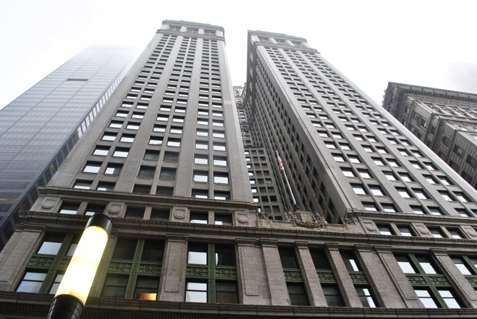
Equitable Life Building
120 Broadway, Manhattan
Ernest R. Graham's Equitable Life Building, completed in 1915 at 120 Broadway, consumed every square inch of its lot. It rose 538 feet straight up from the sidewalk without a single setback, a sheer cliff of limestone and steel that swallowed an entire city block. The building cast a seven-acre shadow over Lower Manhattan, plunging neighboring streets and offices into a permanent midday twilight. Property owners in its shadow watched their rents crater, their tenants flee toward what little sunlight remained.
walk · 0.4 mi · 8 min
Walk east on Fulton Street toward the East River waterfront
From the Equitable Building's shadow, head east along Fulton Street toward the water. You'll pass through the narrow colonial-era streets of the Financial District — some of the oldest in Manhattan — before emerging at the South Street Seaport, where a very different kind of zoning story played out.
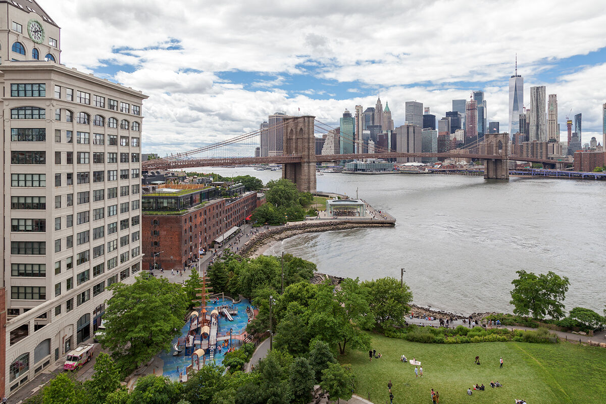
Pier 17 / South Street Seaport
Pier 17, South Street Seaport
Pier 17 at the South Street Seaport has been reinvented twice, and both reinventions required bending the city's zoning rules. The original 1985 development—a Rouse Company "festival marketplace" modeled on Boston's Faneuil Hall—was a suburban-style shopping mall plopped onto the waterfront in a well-meaning but tone-deaf attempt to revitalize Lower Manhattan's decaying port. It attracted tourists but alienated locals, and by the 2000s it was widely regarded as a failure.
walk · 0.6 mi · 12 min
Walk south along the waterfront esplanade toward Battery Park
Follow the East River waterfront south. The esplanade you're walking on exists because of waterfront zoning requirements — every new development along here had to provide public access to the water's edge. A generation ago, this was all cargo piers and chain-link fences.
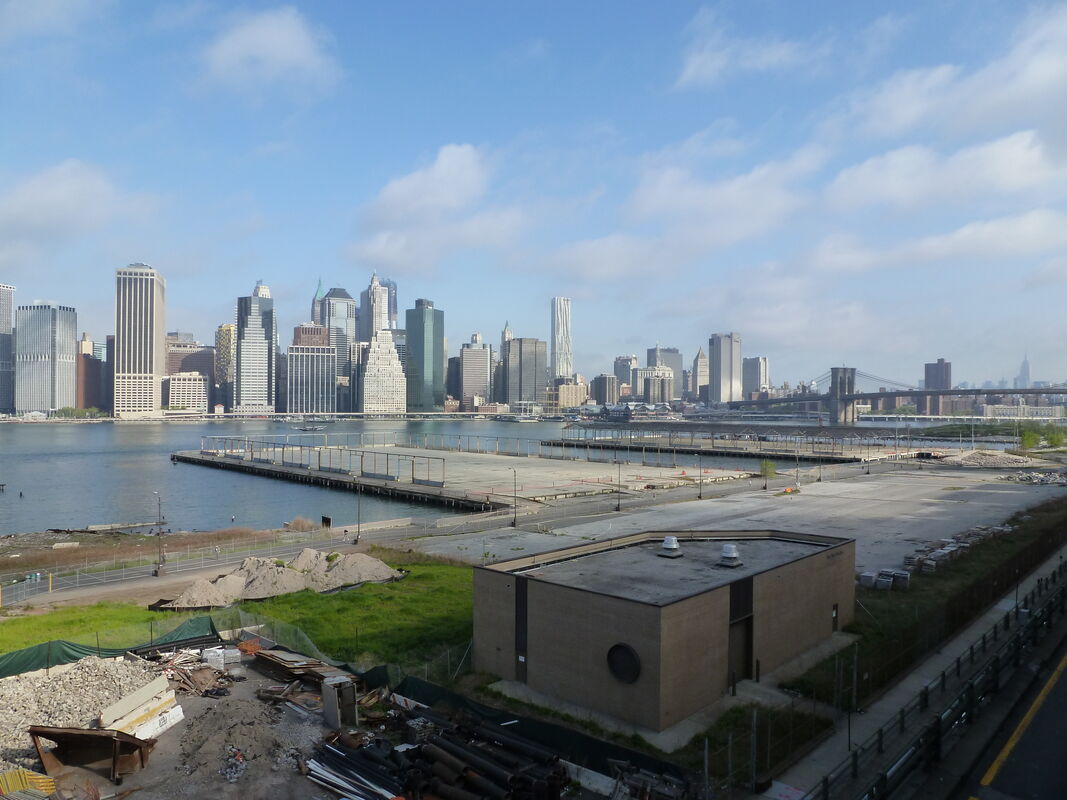
City of Yes (Lower Manhattan Waterfront)
Lower Manhattan
The City of Yes initiative, launched by the Adams administration, represents one of the most sweeping modifications to New York City's zoning resolution in decades. The initiative comprises three distinct but related components: Housing Opportunity, Economic Opportunity, and Carbon Neutrality. Together, they aim to modernize a zoning code that, despite countless amendments, still reflects many of the assumptions of 1961—an era when the city was losing population, manufacturing was a major employer, and climate change was not a consideration.
walk · 4.2 mi · 85 min
Walk north on Broadway, then cut through SoHo to Houston, continue north to Midtown
Now begins the long walk north through the spine of Manhattan. Broadway takes you through the canyon of office towers, past City Hall and the Woolworth Building — Cass Gilbert's 1913 'Cathedral of Commerce' — and into Tribeca, where cast-iron loft buildings that once housed sweatshops now sell for millions. The zoning changed; the buildings stayed.
Setback Skyscraper Mini Game
Various Manhattan locations
The setback skyscrapers of the 1920s and 1930s represent the most creatively productive collision of law and architecture in New York's history. The 1916 Zoning Resolution did not tell architects what their buildings should look like—it told them what shape the sky above their lots could take. Within those invisible envelopes, architects like William Van Alen, Raymond Hood, and Ralph Walker invented an entire vocabulary of stepped massing, decorative crowns, and tapered profiles that became synonymous with the Jazz Age metropolis.
walk · 1.8 mi · 35 min
Walk south on Sixth Avenue to Greenwich Village
Head south from the Midtown towers into Greenwich Village, where the street grid breaks and the city becomes human-scaled again. The Village's irregular streets predate the 1811 Commissioners' Plan and its low-rise brownstones predate zoning entirely — but the preservation of this neighborhood's character has been one of zoning's great ongoing battles.
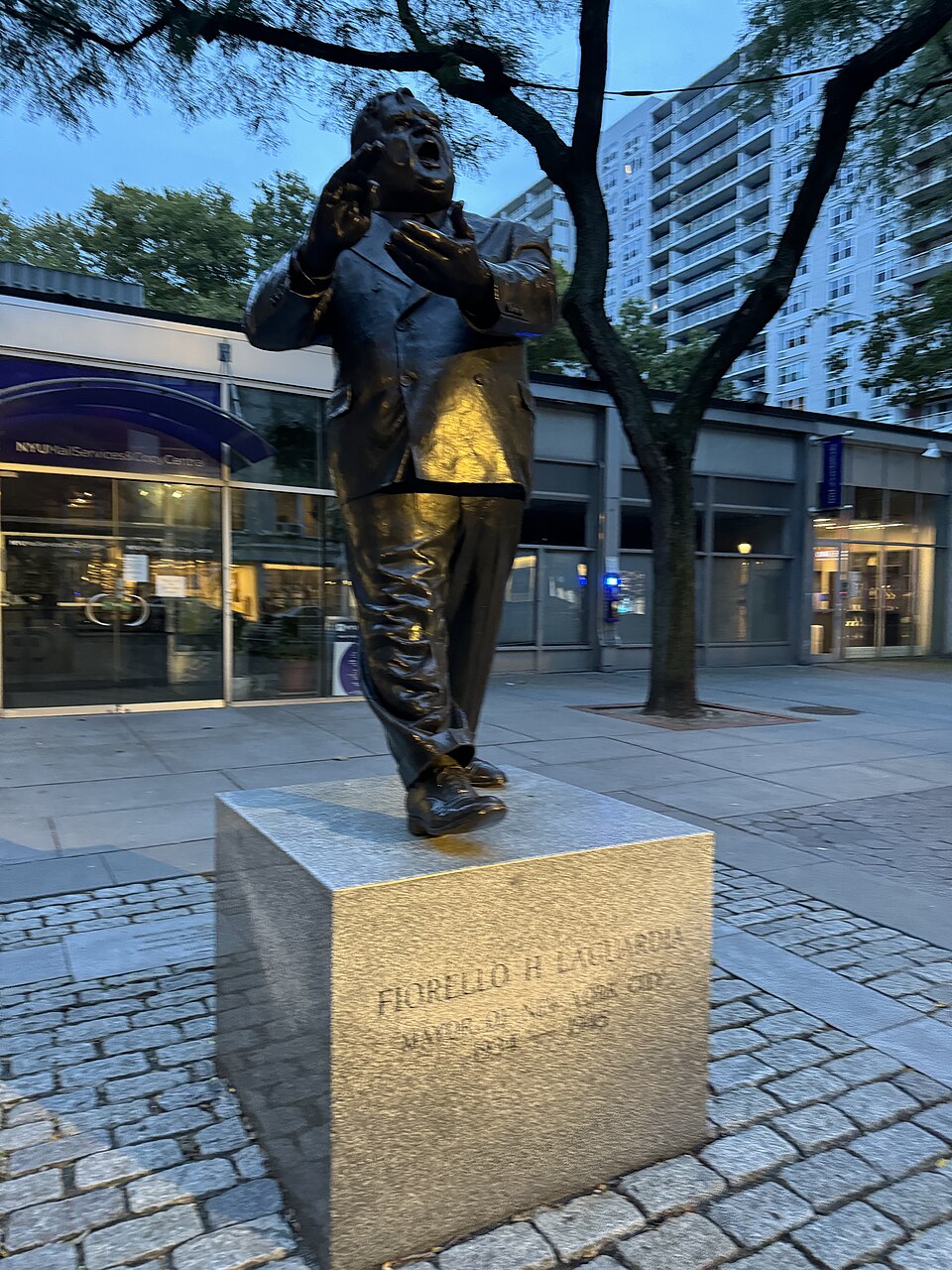
Fiorello LaGuardia Statue
LaGuardia Place, Greenwich Village
The statue of Fiorello LaGuardia that stands in the small Greenwich Village park bearing his name honors a mayor who transformed the physical fabric of New York City more than perhaps any other. Serving three terms from 1934 to 1945, LaGuardia inherited a city mired in Tammany Hall corruption and Depression-era poverty. He responded with an unprecedented building campaign, leveraging New Deal funds to construct highways, bridges, parks, public housing, and the airport that now bears his name.
walk · 0.2 mi · 4 min
Walk west on 12th Street
A short walk west through the Village brings you to the Greenwich Lane, where a women's prison became a garden became luxury condos. Three different zonings, three different New Yorks, one city block.
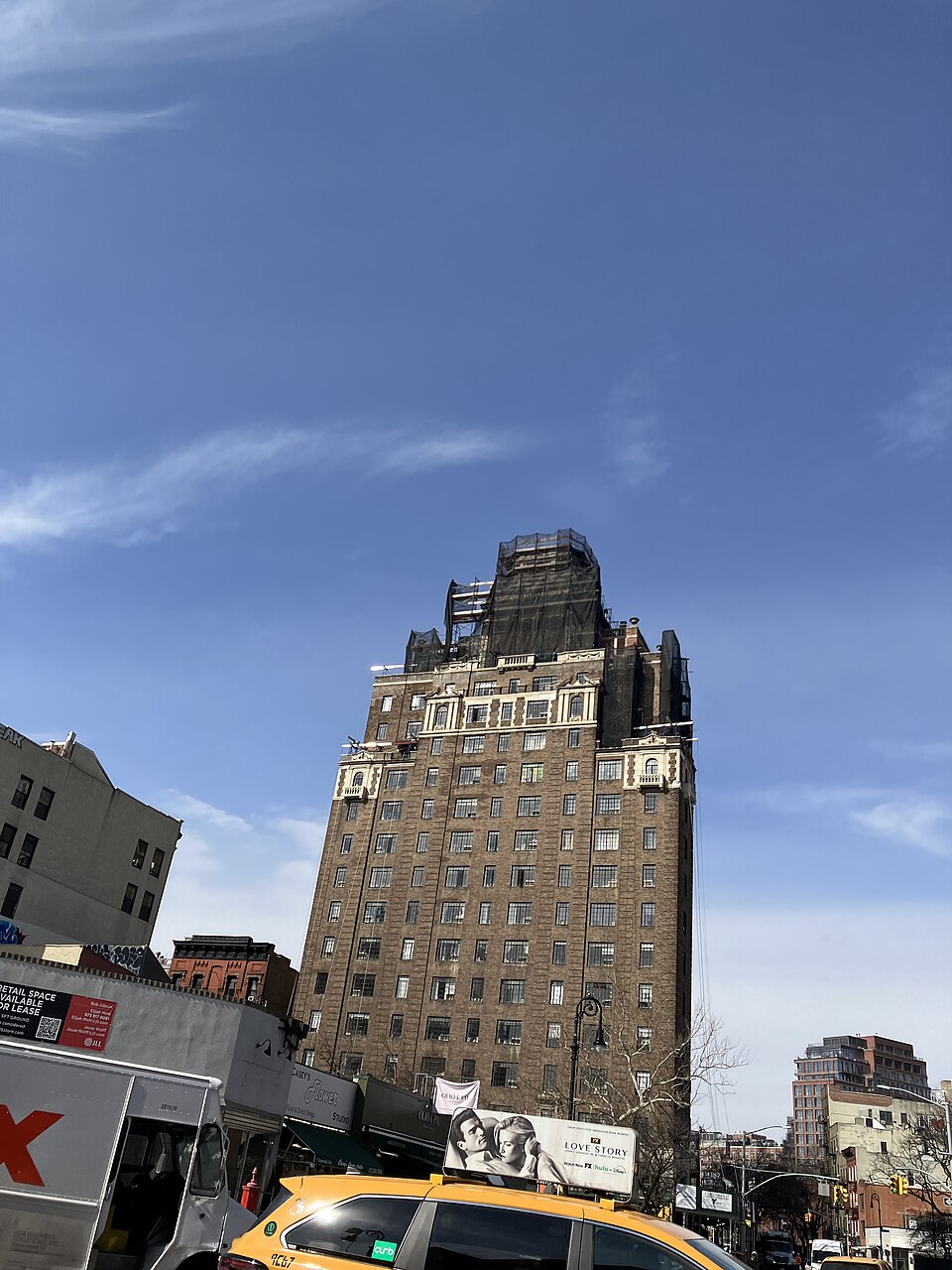
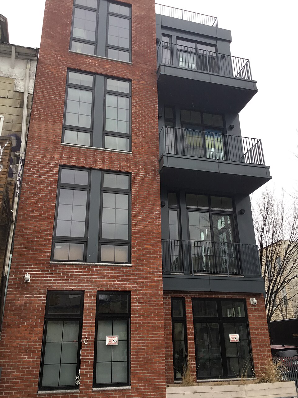
The Greenwich Lane
150-160 W 12th St, Manhattan
The Greenwich Lane, a luxury residential complex at 150-160 West 12th Street, occupies the site of the former Women's House of Detention, a twelve-story Art Deco jail that operated from 1932 to 1974. The prison held women accused of offenses ranging from prostitution to political dissent—Angela Davis was among its most famous inmates. After its demolition, the site became a community garden, and for decades, activists fought to preserve it as public green space in one of the most park-starved parts of the Village.
walk · 0.8 mi · 16 min
Walk east through 14th Street to Gramercy Park
Head east across 14th Street — the dividing line between downtown and uptown in the city's mental geography — toward Gramercy Park. You'll pass through Union Square, one of the city's great public spaces, before reaching the iron fence of New York's most exclusive green space.
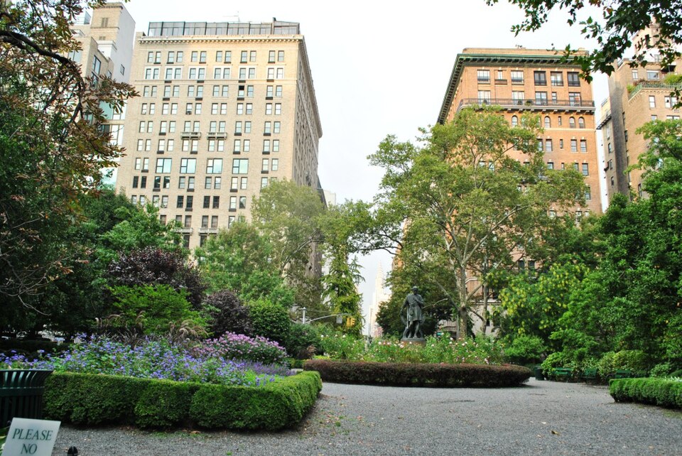
Gramercy Park
Gramercy Park, Manhattan
Gramercy Park is an urban anomaly: a private park in a public city. Established in 1831 by developer Samuel Ruggles, who drained a swamp and deeded the fenced-in green to the owners of the surrounding 66 lots, the park has remained locked to the general public for nearly two centuries. Only residents of the buildings that ring the park receive keys—actual, physical brass keys—and the tradition persists as one of New York's most enduring symbols of residential exclusivity.
walk · 0.5 mi · 10 min
Walk east to Stuyvesant Cove Park along the East River
Continue east to the river. Stuyvesant Cove Park is a quiet stretch of waterfront where Solar One has been teaching New Yorkers about sustainability since before it was fashionable. BIG's redesign will transform it into a showcase for the City of Yes carbon neutrality provisions.
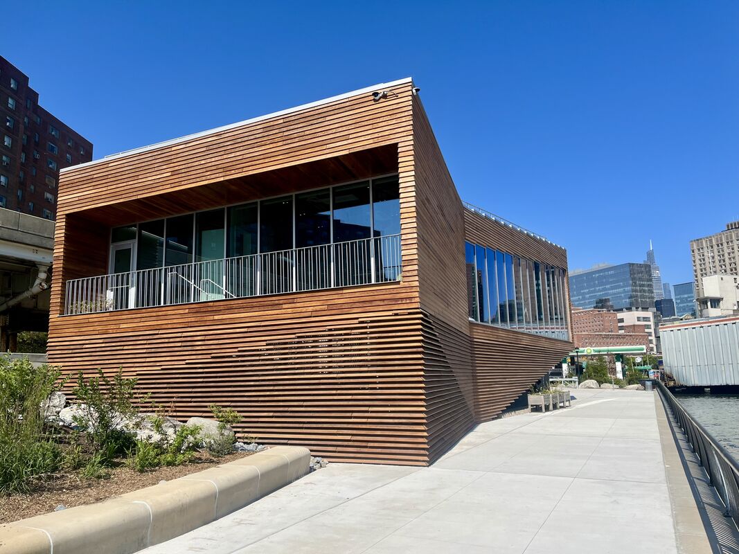
Solar One Environmental Center
Stuyvesant Cove, Manhattan
Solar One, the environmental education center at Stuyvesant Cove on Manhattan's East Side, has been redesigned by Bjarke Ingels Group (BIG) as a new riverfront facility that embodies the principles of the City of Yes for Carbon Neutrality. The nonprofit, whose mission centers on sustainability education and solar energy advocacy, is a natural anchor for the legislation's provisions on renewable energy, which significantly ease the zoning restrictions that have historically made it difficult to install solar panels, wind turbines, and other renewable energy equipment on buildings across the city.
walk · 1.5 mi · 30 min
Walk north and west to the Garment District (34th-42nd, 7th-9th Ave)
Head northwest through Midtown, passing through Kips Bay and Murray Hill — neighborhoods of post-war brick apartment buildings that represent the 1961 FAR-era zoning at its most unremarkable. The Garment District awaits with its rolling racks of fabric, the smell of steam presses, and the ghosts of an industry that zoning tried to save.
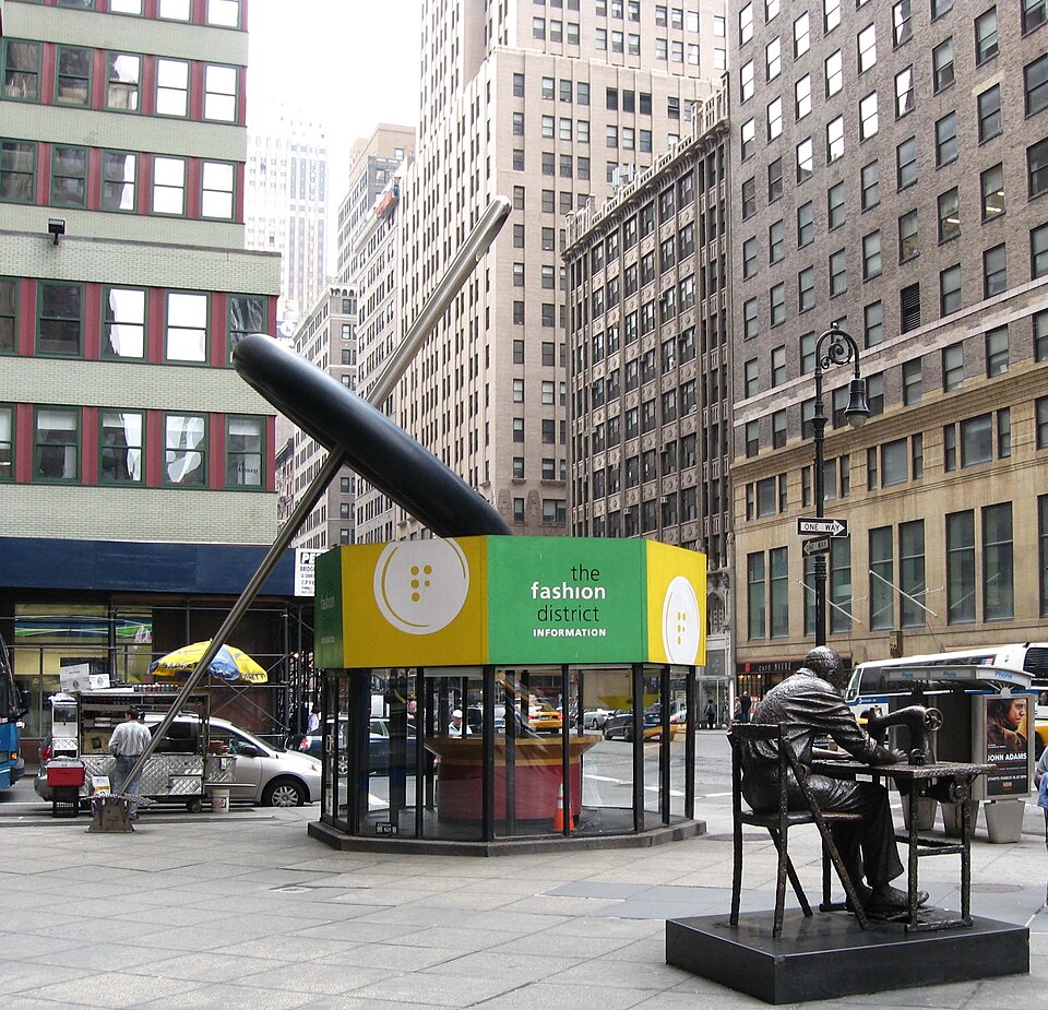
Garment District Mannequin
Garment District, Manhattan
The Garment District, roughly bounded by 34th and 42nd Streets between Fifth and Ninth Avenues, was once the beating heart of American fashion manufacturing. At its peak in the mid-twentieth century, the district employed hundreds of thousands of workers and produced the majority of clothing sold in the United States. The Special Garment Center District, established in 1987, was created specifically to protect this industrial ecosystem from the relentless pressure of Midtown office development.
walk · 0.5 mi · 10 min
Walk east on 42nd Street, then south to view the setback skyline
Cross east through Times Square — you'll come back here later — and head down to a good vantage point for the wedding-cake skyline. Look south from the Public Library steps on Fifth Avenue and 42nd: the setback towers step back in orchestrated rhythm, a hundred architects following the same invisible rules and arriving at a hundred different solutions.
The Wedding Cake Skyline
Various Manhattan locations
The setback rules embedded in the 1916 Zoning Resolution did not dictate a specific architectural style, but they produced one anyway. The law required buildings to step back from the street as they rose, following a diagonal "sky exposure plane" calculated from the center of the road. The wider the street, the taller a building could climb before its first setback. The result was the ziggurat silhouette—what New Yorkers came to call the "wedding cake"—that defines the Manhattan skyline to this day.
walk · 0.3 mi · 6 min
Walk east on 42nd Street to Vanderbilt Avenue
Continue east on 42nd Street, one of the great crosstown arteries. Grand Central Terminal looms ahead — and next to it, the crystalline form of One Vanderbilt rises like a lesson in how zoning can produce buildings that give back to the city.
One Vanderbilt
1 Vanderbilt Ave, Manhattan
One Vanderbilt, the 1,401-foot supertall office tower next to Grand Central Terminal, is the crown jewel of the East Midtown Rezoning—a 2017 zoning change that was specifically designed to encourage the construction of next-generation office towers in the aging Midtown East commercial district. The building, developed by SL Green and designed by Kohn Pedersen Fox, is topped by a tapered crown equipped with 20,000 multi-colored LED lights that can be programmed to display patterns visible from miles away.
walk · 0.5 mi · 10 min
Walk west on 42nd Street to Times Square
Walk back west on 42nd — past Bryant Park, the library, the old porno theaters that are now Disney stores — into the LED canyon of Times Square. The only place in New York where you're legally required to be loud.
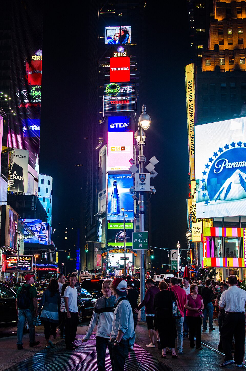
Times Square
Times Square, Manhattan
Times Square is one of the only places in America where you are legally required to be loud. The Midtown Special Purpose District, created in 1982, includes a sub-district specifically for Times Square that mandates illuminated signage on all new development. The regulation was a deliberate attempt to codify the area's essential character: its identity as a spectacle of light and commerce. In a city where most zoning rules tell you what you cannot do, Times Square's zoning tells you what you must.
walk · 0.7 mi · 14 min
Walk east on 52nd or 53rd Street to Park Avenue
Head north and east from the neon overload of Times Square into the cool corporate elegance of Park Avenue. The shift is jarring — from mandatory signage to deliberate restraint in ten blocks. Mies van der Rohe's bronze tower awaits, set behind the plaza that changed zoning forever.
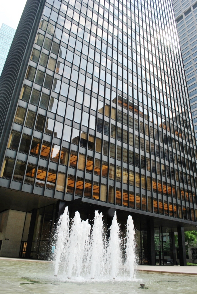
Seagram Building
375 Park Avenue, Manhattan
The Seagram Building at 375 Park Avenue, completed in 1958, is Mies van der Rohe's bronze-clad masterwork and one of the most influential buildings of the twentieth century. Designed in collaboration with Philip Johnson, it rises 38 stories as a sleek, dark curtain wall set behind a half-acre granite plaza—a radical gesture of restraint on an avenue where every developer built wall-to-wall to maximize rentable floor area. Samuel Bronfman, the Seagram whisky magnate, wanted a building that would serve as a corporate monument. Mies gave him a monument to the power of empty space.
walk · 0.5 mi · 10 min
Walk north on Park Avenue to 60th Street, then west to Fifth Avenue
Continue up Park Avenue, past the canyon of post-war office towers — each one built to the maximum FAR, each one featuring a 'bonus plaza' of varying quality — until you reach 60th Street. Turn west to Fifth Avenue, where you'll photograph the street sign that marks one of Manhattan's most consequential zoning boundaries.
60th Street & 5th Avenue
60th St & 5th Ave, Manhattan
The intersection of 60th Street and Fifth Avenue marks one of the most consequential zoning boundaries in Manhattan. To the south stretches the Midtown commercial corridor, one of the densest concentrations of office and retail space on Earth. To the north lies the residential grandeur of the Upper East Side, where zoning has long protected the low-rise, high-wealth character of the neighborhood's side streets while permitting taller buildings along the avenues.
walk · 0.3 mi · 6 min
Walk south on Fifth Avenue, then west to 57th Street
Head south briefly and then west along 57th Street — Billionaires' Row. Steinway Tower's impossibly slender profile dominates the southern sky. The engineering is remarkable; the air rights math that made it possible is even more so.
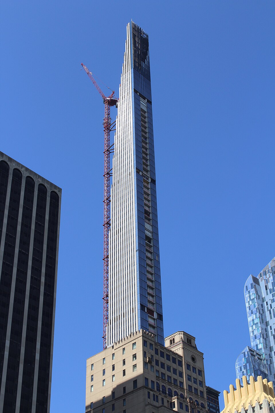
Steinway Tower (111 West 57th Street)
111 W 57th St, Manhattan
Steinway Tower, the impossibly slender residential spire at 111 West 57th Street, rises 1,428 feet above Midtown with a width-to-height ratio of approximately 1:24—making it, by some measures, the most slender skyscraper ever built. Designed by SHoP Architects with interiors by Studio Sofield, the building sits atop the landmarked Steinway Hall, a 1925 showroom for Steinway & Sons pianos. The tower's terra cotta and bronze facade pays homage to the decorative traditions of its Art Deco neighbors along Billionaires' Row.
walk · 0.6 mi · 12 min
Walk north on Broadway to Lincoln Center (62nd-66th Street)
Walk north past Columbus Circle — where the Time Warner Center marks the edge of the Central Park South luxury corridor — and up Broadway to Lincoln Center. The fountain plaza opens before you, framed by Eero Saarinen's Vivian Beaumont Theater and Philip Johnson's New York State Theater. This is where the Special Purpose District was born.
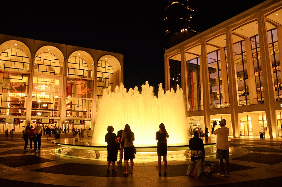
Lincoln Center / First Special Purpose District
Lincoln Center, Manhattan
In 1969, the city created its very first Special Purpose District around Lincoln Center for the Performing Arts, the 16.3-acre cultural campus on the Upper West Side whose first venue—Philharmonic Hall, now David Geffen Hall—had opened in 1962. The Special Lincoln Square District was crafted to encourage the concentration of cultural facilities, limit building height in the immediate vicinity of the campus, and improve pedestrian flow between the center's theaters, opera house, and concert halls.
walk · 2.0 mi (with subway) · 25 min
Walk south to the High Line entrance at 34th Street (take subway or walk)
The High Line is a 30-block detour south, but worth every step. Take the 1 train from 66th to 34th-Penn Station, then walk west to the elevated park's northernmost entrance. As you walk south along the High Line, you're walking through the West Chelsea Special Purpose District — the zoning framework that saved this rail line and transformed an entire neighborhood.
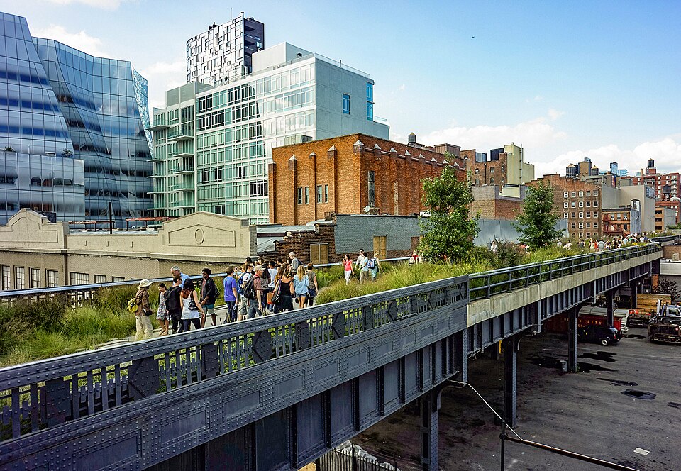
The High Line / West Chelsea SPD
High Line, Manhattan
The High Line—a 1.45-mile elevated park built on a disused freight rail line on Manhattan's West Side—is perhaps the most celebrated adaptive reuse project in the world. But the park's existence required a zoning intervention as creative as its design. The Special West Chelsea District, established in 2005, was crafted specifically to facilitate the High Line's preservation and transformation while managing the explosive development that the park would inevitably attract.
subway · 3.5 mi · 15 min
Take the 7 train from 34th St-Hudson Yards to Court Square, walk to Anable Basin
Board the 7 train at Hudson Yards — itself one of the great zoning stories, a rail yard decked over to create a new neighborhood from thin air. The 7 takes you under the East River to Long Island City, where the Amazon HQ2 drama played out and the Innovation QNS rezoning is remaking 54 blocks.
Anable Basin / Innovation QNS
Long Island City, Queens
Anable Basin, a small inlet along the Long Island City waterfront in Queens, achieved national notoriety in 2018 when Amazon announced it would build its HQ2 on the surrounding blocks—a plan that collapsed within months under a barrage of community opposition, political maneuvering, and concerns about public subsidies for the world's richest company. The basin sits at the southern edge of a 54-block area that has since been the subject of a different, more democratic development process.
walk · 1.2 mi · 24 min
Walk north along the waterfront to Halletts Point
Follow the Long Island City waterfront north toward Astoria. The waterfront here is a parade of new residential towers — each one the product of a rezoning, each one rising where warehouses stood a decade ago. The Durst Organization's Halletts Point towers come into view as you approach the northern tip of the peninsula.
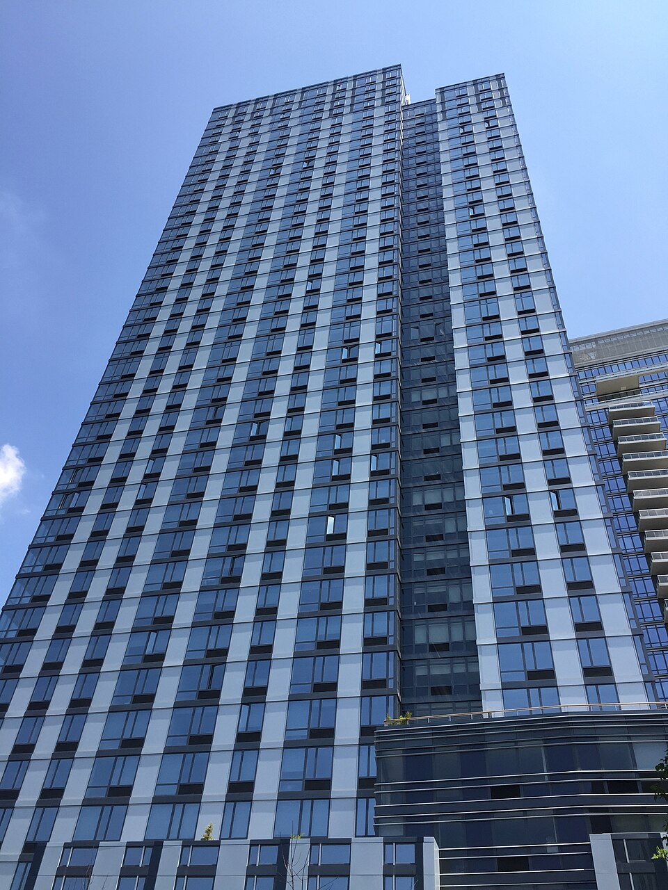
Halletts Point (Astoria, Queens)
Astoria, Queens
The fraternal twin towers at Halletts Point—standing 27 and 32 stories along the Astoria waterfront—are the latest phase of a massive residential development by the Durst Organization on a formerly industrial stretch of the East River. The site, near the NYC Ferry stop that opened in 2017, exemplifies a pattern that has reshaped the city's waterfront over the past two decades: the systematic rezoning of industrial parcels for high-rise housing, complemented by new public parks and waterfront esplanades.
subway · 8 mi · 35 min
Take the N/W from Astoria Blvd to Flushing-Main Street (transfer at Queensboro Plaza to the 7)
The 7 train to Flushing is one of the great subway rides in the world. Each stop marks a different immigrant community — Indian, Filipino, Chinese, Korean — and the architectural character shifts with each. By the time you emerge at Main Street, you're in the largest Chinatown in the Western Hemisphere.

Downtown Flushing SPD
Downtown Flushing, Queens
The 30-story, 669-unit residential building that rises above Downtown Flushing is the tallest structure in a neighborhood that has been one of the most dynamic commercial centers in the city for over a century. Flushing's Main Street and Roosevelt Avenue corridors are the heart of the largest Chinatown in the Western Hemisphere—a bustling, polyglot district where Mandarin, Cantonese, Korean, and a dozen other languages compete for airspace alongside English.
subway · 4 mi · 15 min
Take the 7 train back toward Manhattan, exit at 46th St-Bliss Street for Sunnyside Yards overlook
Ride the 7 back westward. Between the 33rd and 40th Street stations, look out the window to your left: the vast expanse of Sunnyside Yards spreads below, 180 acres of rail lines that could someday hold 24,000 apartments. It's the biggest development site in the city, hiding in plain sight.
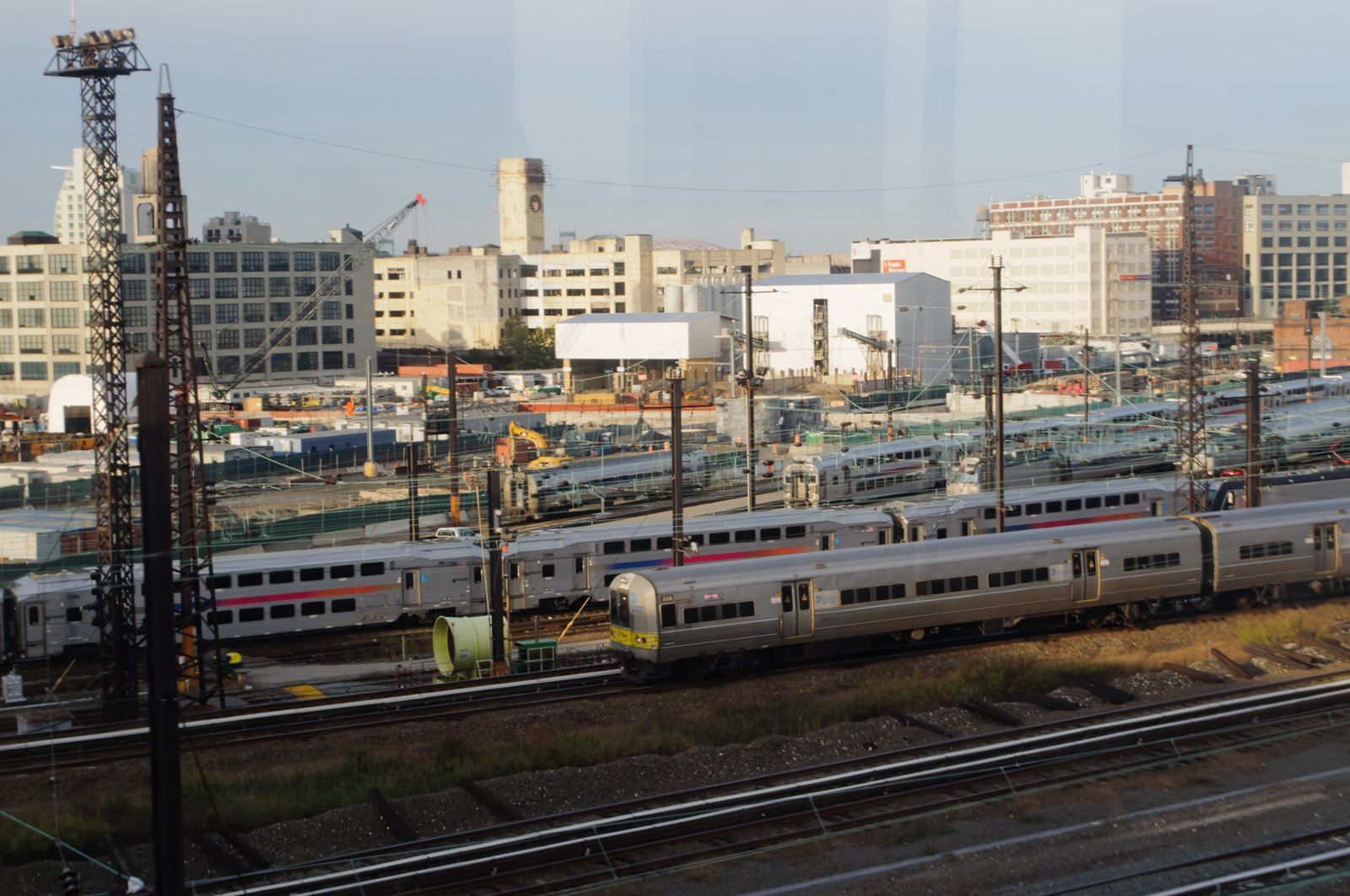
Sunnyside Yards (Queens)
Sunnyside, Queens
Sunnyside Yards is one of New York City's great what-ifs: a 180-acre rail yard in western Queens that represents perhaps the largest undeveloped site within sight of the Manhattan skyline. The yard, owned by Amtrak, serves as a storage and maintenance facility for Long Island Rail Road trains. Its sheer size—equivalent to roughly 130 city blocks—has made it the subject of development speculation for decades, with proposals ranging from the modest to the megalomaniacal.
subway · 12 mi · 50 min
Take the 7 to Jackson Heights, transfer to E/F to Jamaica, then A to Broad Channel
The journey to Broad Channel requires commitment — it's the A train's lonely run across Jamaica Bay on a narrow trestle. As the train crosses the water, look out at the marshlands: this is one of the last wild places in New York City, and the houses below you are built on stilts for a reason Hurricane Sandy made terrifyingly clear.
Broad Channel (Special Coastal Risk District)
Broad Channel, Queens
Broad Channel is one of the most improbable neighborhoods in New York City: a small island community in the middle of Jamaica Bay where houses are built on stilts above the water, boats are parked in driveways, and the nearest subway station feels like a portal between two different worlds. The neighborhood's vulnerability to flooding was always obvious, but it took Hurricane Sandy in 2012—which inundated the island and destroyed or damaged hundreds of homes—to force the city to confront the question of what should be built in places where the water will inevitably return.
subway · 5 mi · 20 min
Take the A train back to Howard Beach, transfer to bus or return to Queens Boulevard
Head back across Jamaica Bay. Queens' residential neighborhoods spread in every direction — the zoning districts that the 1916 resolution created are visible in the built form. Single-family houses give way to row houses, then to apartment buildings along the commercial corridors, each transition marking a boundary on the invisible zoning map.
Zoning Districts of Queens
Queens, NY
The 1916 Zoning Resolution established a principle that remains foundational to this day: the segregation of land use into distinct categories. Every parcel in New York City is assigned a zoning designation that determines what can be built on it—residential, commercial, or manufacturing. Queens, with its sprawling geography and extraordinary diversity of built environments, offers perhaps the clearest illustration of how these categories shape the texture of daily life.
subway · 6 mi · 30 min
Take the L train from Broadway Junction to Bedford Avenue for Williamsburg waterfront
Cross from Queens to Brooklyn via the L train — the line that transformed Williamsburg from a sleepy industrial neighborhood into the epicenter of Brooklyn's reinvention. Exit at Bedford Avenue and walk toward the water. The glass towers that have replaced the warehouses are a monument to the 2005 rezoning.
Williamsburg Waterfront Park
Williamsburg, Brooklyn
The sloped green space designed by Kiss + Cathcart along the Williamsburg waterfront is the single completed section of Bushwick Inlet Park, a 28-acre park that was promised to the community as part of the famously contentious 2005 Greenpoint-Williamsburg rezoning. That rezoning transformed a mile of industrial waterfront into some of the most expensive residential real estate in Brooklyn, permitting glass towers up to 40 stories where sheet-metal warehouses once stood.
walk · 1.5 mi · 30 min
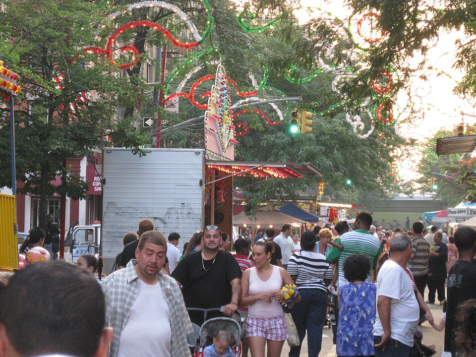
Walk south through Williamsburg to Bushwick along Flushing Avenue
Head south and east from the waterfront into the heart of Bushwick. The neighborhood transitions from rezoned waterfront towers to scrappy industrial blocks where the Rheingold Brewery once produced beer for half of Brooklyn. ODA's angular residential blocks announce the next chapter of change.
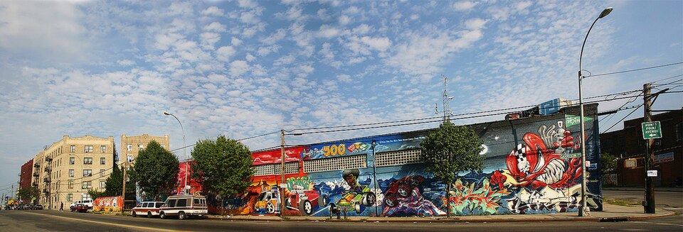
Rheingold Brewery Site (ODA Architecture)
Bushwick, Brooklyn
The Rheingold Brewery site in Bushwick is a cautionary tale about the gap between zoning promises and zoning outcomes. The five-block parcel was once home to the Rheingold Brewing Company, a Brooklyn institution whose "Miss Rheingold" beauty pageant was a mid-century cultural phenomenon. After the brewery closed in 1976, the site sat largely vacant for decades, a hulking reminder of the borough's industrial decline.
subway · 3 mi · 15 min
Take the F/G from Bergen Street to the Gowanus area
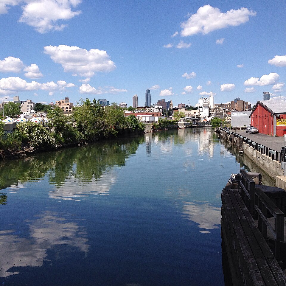
The F train takes you to Gowanus, where the rezoning of a Superfund canal corridor into a residential neighborhood is one of the most audacious bets in modern urban planning. The canal still smells like history — specifically, the toxic-waste kind.
Gowanus Rezoning Corridor
Gowanus, Brooklyn
The park at the northern end of the Gowanus rezoning corridor—named for a U.S. Vice President and featuring a Spanish-American War monument—marks the starting point of one of the most closely watched rezonings of the de Blasio era. In 2019, the city approved the rezoning of a 14-block corridor along the Gowanus Canal from industrial to mixed-use, paving the way for approximately 8,500 new apartments, new schools, and new parks along one of the most polluted waterways in America.
walk · 1.2 mi · 24 min
Walk south through Carroll Gardens to Red Hook
Walk south through Carroll Gardens — brownstone Brooklyn at its most picturesque — and under the Gowanus Expressway into Red Hook. The Swedish big-box store rises before you, a suburban building in an urban setting, with its own ferry dock.
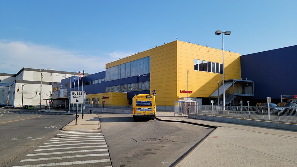
IKEA Brooklyn (Red Hook)
1 Beard St, Brooklyn
When the City Planning Commission approved the rezoning of a former shipyard in Red Hook to allow the construction of a 346,000-square-foot IKEA store in 2004, the decision was both celebrated and mourned. Red Hook, an isolated waterfront neighborhood separated from the rest of Brooklyn by the elevated Gowanus Expressway, had been struggling economically for decades. The promise of a major retailer—with jobs, foot traffic, and the implicit validation that a global corporation saw potential in the neighborhood—was genuinely exciting to many residents.
walk · 0.8 mi · 16 min
Walk south along the Red Hook waterfront to the Container Terminal
Continue along Red Hook's waterfront to the Container Terminal — 122 acres of working port that's about to become something nobody in New York has tried before: an all-electric port and residential neighborhood, industry and housing sharing the same waterfront.
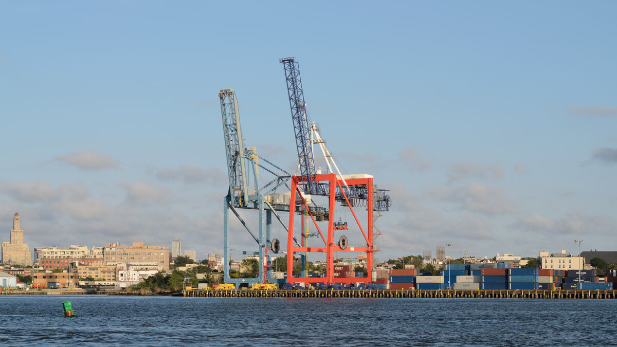
Red Hook Container Terminal
Red Hook, Brooklyn
The Red Hook Container Terminal, a 122-acre site on Brooklyn's southwestern waterfront, has been approved for one of the most ambitious rezonings in the city's recent history: the transformation of an aging maritime facility into a modernized, all-electric port alongside a new mixed-use residential community. The project represents a rare attempt to preserve working waterfront infrastructure while simultaneously building housing—two goals that have traditionally been seen as incompatible.
walk · 0.5 mi · 10 min
Walk north along the Brooklyn waterfront
Follow the waterfront esplanade north. Everywhere you look, the pattern repeats: industrial waterfront becomes residential waterfront, and the public gets access to the water's edge. City of Yes is making these requirements even stricter.
Brooklyn Waterfront (City of Yes)
Brooklyn Waterfront
This Brooklyn waterfront site, with its 54,800 square feet of publicly accessible waterfront space, represents the convergence of two major trends in New York City zoning: the ongoing conversion of industrial waterfronts to mixed-use development, and the City of Yes initiative's emphasis on public access and environmental quality. The amount of public space on this site would have been unthinkable a generation ago, when Brooklyn's waterfront was a working industrial edge dominated by warehouses, fuel depots, and waste transfer stations.
subway · 2 mi · 15 min
Take the R/D/N from Atlantic Ave-Barclays Center area
Head to the Atlantic Avenue hub — where the Barclays Center and the Pacific Park towers represent one of the most contentious development sagas in Brooklyn history. The mandatory inclusionary housing that's being tested here is reshaping who gets to live in the new Brooklyn.
Mandatory Inclusionary Housing (Brooklyn)
Brooklyn, NY
Mandatory Inclusionary Housing, or MIH, is one of New York City's most ambitious attempts to harness the power of private development for public benefit. Adopted in 2016 under Mayor de Blasio, MIH requires that any development in a rezoned area set aside a permanent percentage of its units as affordable housing. The policy was born from decades of frustration with voluntary inclusionary programs, which produced far fewer affordable units than the city needed.
subway · 8 mi · 40 min
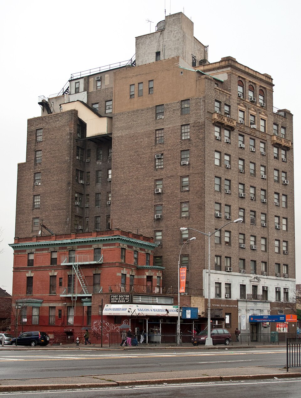
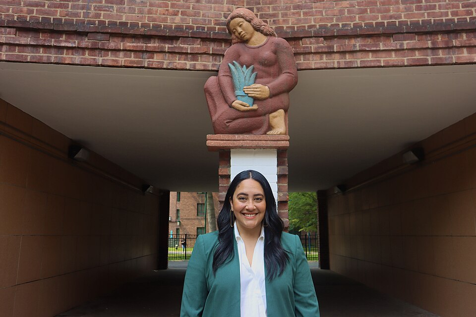
Take the 6 train from Hunts Point station (or take the 2/5 to Simpson St)
Cross into the Bronx — the borough that has been shaped as much by disinvestment as by investment. The 6 train takes you to Hunts Point, where the city's largest food distribution center shares space with a remarkable story of transformation: a juvenile prison reborn as affordable housing.
Inspiration Point (Hunts Point, Bronx)
Hunts Point, Bronx
The story of Inspiration Point begins with the Spofford Juvenile Center, a notorious detention facility in Hunts Point that held children as young as seven in conditions that advocates described as inhumane. After decades of protest, Spofford was finally shuttered in 2011, and the five-acre site sat vacant as the city debated its future. In 2018, the land was rezoned, and what has risen in its place is a remarkable act of urban transformation: 740 units of 100 percent affordable housing, community spaces, and a cultural arts center called Inspiration Point.
subway · 3 mi · 20 min
Take the 6 to 3rd Ave-149th St, transfer to 2/5 to 161st St-Yankee Stadium, walk to Bronx Point
Head north along the Bronx waterfront to Bronx Point, where the Universal Hip Hop Museum is rising. The South Bronx gave the world hip hop; now the Special Purpose District here is giving the neighborhood a new waterfront identity.
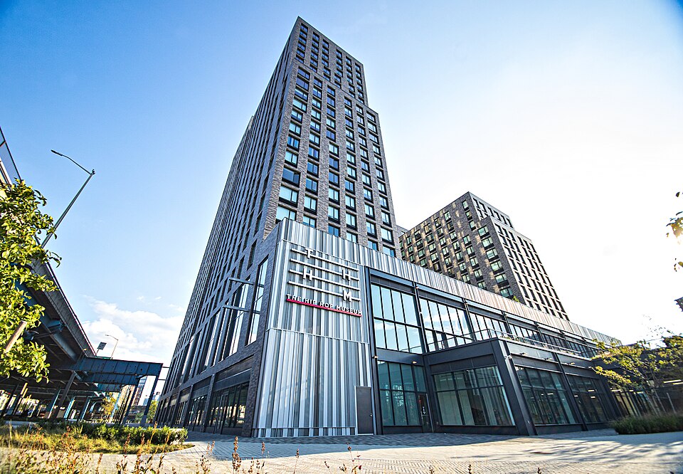
Universal Hip Hop Museum (South Bronx)
Bronx Point, Bronx
The Universal Hip Hop Museum, founded by music producer Rocky Bucano and currently slated to open in fall 2026, is rising at Bronx Point, a mixed-use development at the northern edge of the Special Harlem River Waterfront District. The museum will anchor the cultural identity of a neighborhood that gave birth to hip hop in the 1970s—a neighborhood that is now being physically remade through one of the most ambitious waterfront rezonings in the borough's history.
subway · 2 mi · 10 min
Take the B/D to 167th St on the Grand Concourse
Ride the B/D up the Grand Concourse — the Bronx's Champs-Elysées. Art Deco apartment buildings line both sides, their terra cotta ornaments and decorative lobbies protected by a Special Purpose District that treats them as the treasures they are.
Fish Building / Grand Concourse SPD
Grand Concourse, Bronx
The building known colloquially as the "Fish Building" on the Grand Concourse in the Bronx is instantly recognizable by its fanciful aquatic mosaic murals—shimmering fish, seahorses, and underwater scenes rendered in tile on its facade. The building is one of the most visible landmarks along the Grand Concourse, the 5.2-mile boulevard that Bronx Borough President Louis Risse designed in 1894 as the borough's answer to the Champs-Elysées.
subway · 4 mi · 20 min
Take the 6 from Parkchester station
Continue east to Parkchester — MetLife's city-within-a-city. The 129 red-brick buildings and their whimsical terra cotta sculptures represent a kind of development New York doesn't do anymore: an entire neighborhood designed by one hand, built at once, and preserved as a whole.
Parkchester (Bronx)
Parkchester, Bronx
Parkchester is a city within a city: a 129-building, 12,271-unit residential complex in the east Bronx that was developed by the Metropolitan Life Insurance Company and completed in 1942. Designed by the architectural firm of Richmond Shreve (of Empire State Building fame) and Andrew Eken, the development covers 129 acres and was, at the time of its construction, the largest privately financed housing development in the country. Its red-brick buildings are arranged around courtyards and green spaces, and its facades are adorned with terra cotta sculptures—whimsical animal figures, decorative medallions, and architectural ornaments that give the complex a distinctive character.
subway · 6 mi · 25 min
Take the 4 train to Kingsbridge Road
Head to the northwest Bronx, where the massive Kingsbridge Armory has been waiting for its next chapter for decades. The armory's drill hall is so vast it could swallow Madison Square Garden — and its redevelopment has been stalled by the same community politics that make New York zoning so complicated.
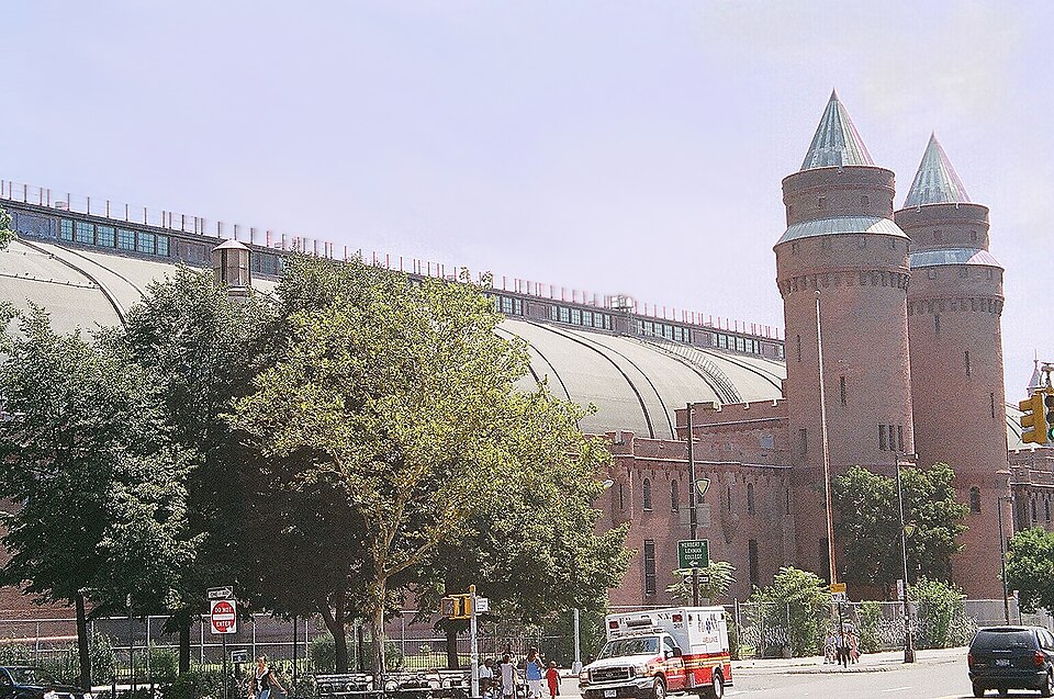
Kingsbridge Armory (Bronx)
Kingsbridge, Bronx
The Kingsbridge Armory in the northwest Bronx is one of the largest armories in the world: a cavernous, 750,000-square-foot brick fortress completed in 1917, with a drill hall so vast that it could comfortably hold the entirety of Madison Square Garden's arena floor. The building has been largely vacant since the 1990s, and its redevelopment has been the subject of nearly two decades of proposals, protests, and political maneuvering.
walk · 1.5 mi · 30 min
Walk through Bronx residential neighborhoods
Walk through the Bronx's residential neighborhoods, where the City of Yes ADU provisions could transform thousands of single-family lots. Every house with a garage or a basement is a potential new housing unit — if the homeowner chooses to build it.
Accessory Dwelling Units (Bronx)
The Bronx, NY
Accessory Dwelling Units—ADUs—are small, self-contained housing units built on the same lot as an existing home. They might be basement apartments, garage conversions, or backyard cottages. For decades, New York City's zoning code effectively prohibited them in most residential neighborhoods, treating the single-family home as an inviolable unit. The City of Yes for Housing Opportunity, adopted in 2024, changed that, legalizing ADUs across the city for the first time.
ferry · 25 mi (including subway) · 90 min
Take the 1 train to South Ferry, then the Staten Island Ferry to St. George Terminal
The final borough requires the city's most iconic free ride: the Staten Island Ferry. As you cross the harbor, the Manhattan skyline recedes behind you — every building in that skyline shaped by the zoning rules you've now spent days learning to see. Staten Island awaits with its own, very different relationship to density and development.
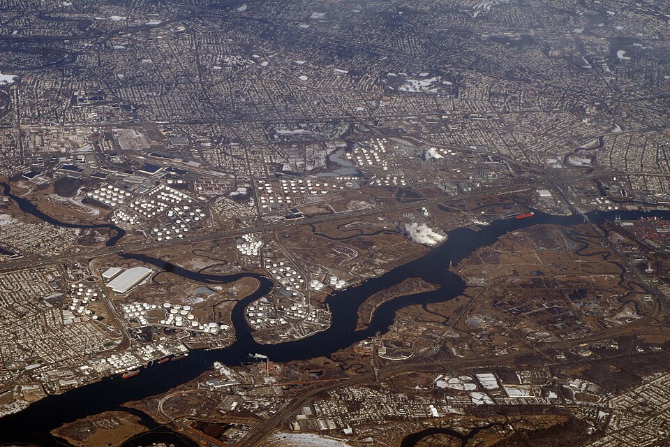
Staten Island Special Purpose District (West Shore)
Staten Island, NY
The Special West Shore District, established in 2021, represents one of the city's most ambitious attempts to reimagine a major industrial area for a twenty-first-century economy. The West Shore of Staten Island is home to some of the borough's largest remaining industrial parcels—formerly the domain of oil storage tanks, distribution centers, and the kind of heavy industry that has been steadily departing the city for decades.
bus · 5 mi · 25 min
Take the S40 bus along the West Shore
The bus along Staten Island's West Shore takes you through the industrial landscapes that the Special West Shore District is trying to reimagine. Oil tanks and distribution centers line the road — the last vestiges of an industrial economy that the borough is trying to evolve, not erase.

Floor Area Ratio (Staten Island)
Staten Island, NY
Floor Area Ratio—FAR—is perhaps the single most important number in New York City zoning, and yet most New Yorkers have never heard of it. Introduced in the 1961 Zoning Resolution, FAR replaced the complex setback formulas of 1916 with a deceptively simple concept: the total floor area of a building, divided by the area of its lot. A FAR of 1.0 means you can build one square foot of floor space for every square foot of lot. A FAR of 10.0 means ten square feet per lot foot—a ten-story building covering the entire lot, or a twenty-story building covering half of it.
walk · 1.0 mi · 20 min
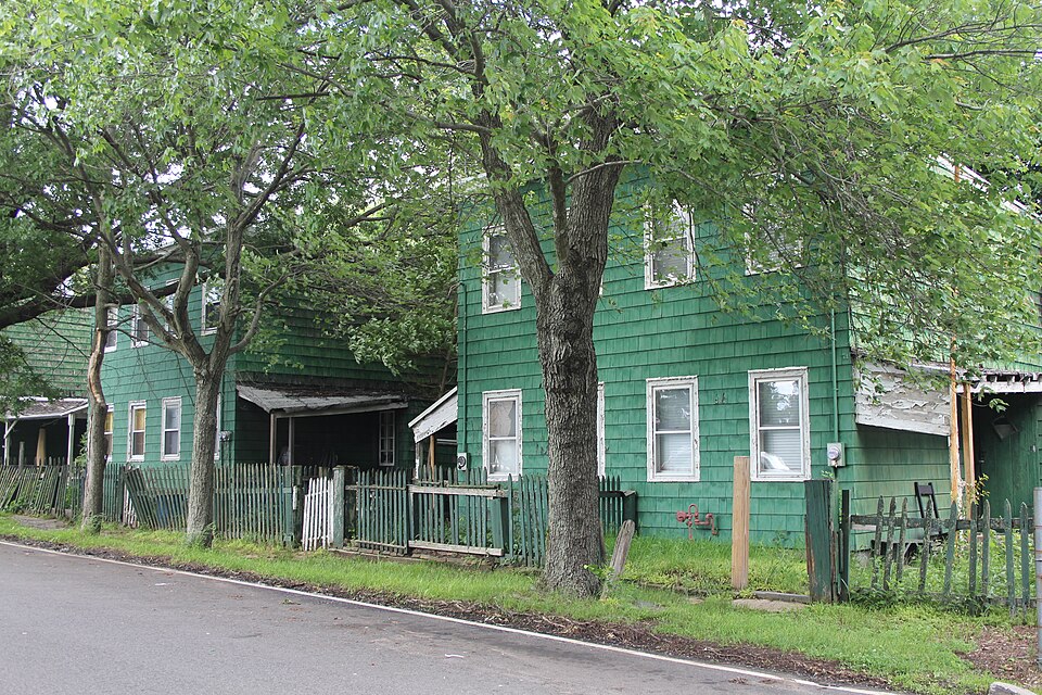
Walk through Staten Island's residential neighborhoods
Staten Island's low-density residential neighborhoods show what a FAR of 0.5 looks like: detached houses, front lawns, driveways. It's the most suburban borough, and the City of Yes mass timber provisions could bring a new building type to these streets — mid-rise wood buildings, denser but lighter than anything here today.
Mass Timber Construction (Staten Island)
Staten Island, NY
The City of Yes for Carbon Neutrality includes provisions to encourage mass timber construction—an emerging building technology that uses engineered wood products like cross-laminated timber (CLT) to construct mid-rise and even high-rise buildings. Mass timber has a significantly lower embodied carbon footprint than steel or concrete, the materials that have dominated New York construction for over a century. By easing zoning restrictions on mass timber, the city is attempting to open the door to a building material that could meaningfully reduce the carbon impact of new construction.
Final Stop
Return to St. George Terminal via bus for the ferry back to Manhattan
Your tour ends where New York's story continues — in the constant push and pull between growth and preservation, density and character, public good and private profit. Every building you've visited, every street you've walked, every neighborhood you've passed through exists in the shape it does because someone drew a line on a map. Now you know how to read between those lines.